Satellite images have become a major feature of investigative reporting. But while freelance journalists have more tools on their hands than ever before to use satellite images, they remain a complementary technological tool, as MCJN member Omnia El Desoukie has learned during the ARIJ annual forum of 2018
While it is still very difficult to track human beings being trafficked or smuggled across borders, we can still track the movements of ships and vehicles that are used for trafficking.
Ever since I attended the session on the use of satellite imagery in investigative journalism, I have been attempting to use Google Earth to “spy” on The Mariana Trench in the Western part of the Pacific Ocean, which is known as the deepest spot on our planet. This is just out of curiosity. But as a freelance journalist, my real interest in satellite imagery comes from the need to explore different resources to conduct my research in areas where I cannot travel, either due to cost or safety issues.
While it is still very difficult to track human beings being trafficked or smuggled across borders, we can still track the movements of ships and vehicles that are used for trafficking.
The session, entitled “combining high-tech and old-fashioned gumshoe reporting in global security investigations”, was conducted by Josh Meyer, chief investigative reporter of POLITICO, and Jeff Stein, the founder of Macroscope, which is a California-based high-tech company that offers services to investigative journalists.
Satellite imagery refers to images of our planet that are captured by using the light that our earth reflects back. The data is then digitised and processed into an image. Some would describe satellite imagery as “our eyes in the sky.”
The technology still has its limitations, especially when it come to image resolution. So while it is still very difficult to track human beings being trafficked or smuggled across borders, we can still track the movements of ships and vehicles that are used for trafficking.
When Human Rights Watch investigated the persecution of the minority Rohingya Muslims by the Burmese government, it also relied on satellite imagery
During the session, we looked at two examples where stories could not have been told without satellite imagery, such as Josh Meyer’s piece in Politico entitled The secret backstory of how Obama let Hezbollah off the hook. This was an investigation into how the Obama administration “derailed” a law enforcement campaign against Hezbollah in order to secure the nuclear deal with Iran. The piece itself provides a detailed account on the story. But what is interesting for us is how they used satellite imagery in West Africa to document Hezbollah’s activity in trading cars as part of their money laundering operation.
When Human Rights Watch investigated the persecution of the minority Rohingya Muslims by the Burmese government, it also relied on satellite imagery, which revealed widespread fire within Rohingya villages. The organisation said the images proved that the destruction of those villages was greater than expected. They were even able to verify that around 430 houses were destroyed on three different dates in 2016.
In April 2018, the US, UK and France said they attacked three sites in Syria with 105 missiles, in response to an alleged chemical attack in Douma. The Syrian government denied any damage to those sites, but satellite imagery was provided to prove the opposite. The US Department of Defence had released “before-and-after” images to prove this. But instead of publishing the images as they are, media channels such as CNN took the images to independent firms, such as DigitalGlobe and Planet.com, to verify them. The images showed extensive damage at two separate facilities, during two different days. The third site was picture produced by Planet.com, showed that missiles brought down the Bazrah Research Center in Damascus into ruins.
Advantages of using satellite imagery
how can we be sure of the accuracy of photos or videos streaming on social media?
Validating information: how can we be sure of the accuracy of photos or videos streaming on social media? In July 2018, a gruesome video went viral on the internet, showing African soldiers killing two women and two children, after accusing them of belonging to the militant group Boko Haram. The killing had taken place in a remote village that could be anywhere along the vast Sahel region in Africa. Many viewers said the attack had taken place in Mali, but a BBC investigation used satellite images to show that it had in fact taken place in Cameroon. It began by following the topography of the mountain range that appeared in the background and from there was able to verify the houses in the video and find the exact location of the execution.
Visual storytelling: if you are working on a long, word-heavy investigation, using satellite images (where applicable) is important to help your readers visualise the topic. It is also there as visual proof of your hypothesis, which adds credibility to your reporting.
Limitations of satellite imagery:
Image resolution is still a major challenge. As freelance journalists, we may rely mostly on free applications such as Google Earth, where not all images have good resolution. Even with the most sophisticated apps or satellite image providers such as DigitalGlobe, the resolution is still limited. We may detect movements of persons but we still cannot zoom in to identify their faces. Also with vehicles, it’s still impossible to zoom in to detect the models or number plates.
As a freelance journalist, you would need to turn to expert companies to help understand those images, especially if you’re new to satellite imagery.
Can satellite images be tampered with? I wasn’t able to get a satisfactory answer on this question during the session. But in May 2015, UK-based website Bellingcat, which provides analysis of satellite images and data from conflict zones, published a report saying that Russia had faked satellite images pertaining to the downing of Malaysian airliner MH17 in July 2014, in order to shift the blame the Ukraine.
You would need multiple satellite images to be able to detect and compare changes in landscape or movement. It will not be done by using one or two images only. As a freelance journalist, you would need to turn to expert companies to help understand those images, especially if you’re new to satellite imagery.
So overall, while satellite images can help in validating information, they remain a complementary technological element to a story. Therefore, before you embark on a Google Earth search, you should know exactly what you are looking for. So in an investigative piece, this means you should have a clear hypothesis established, then narrow your focus and decide how you are going to use satellite research to prove it. Satellite images could help validate your story, but they cannot be the sole - let alone main - source.
If you are interested in reading more about the topic, Reuters have a comprehensive guide on satellite imagery here. I also found some useful tools if you want to use applications more advanced than Google Earth.
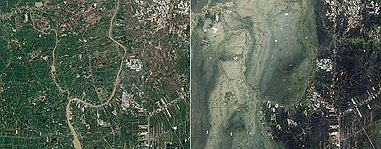
*photo: damage caused by flooding in Thailand in 2011, from Wikipedia.com